📸 Photo Description
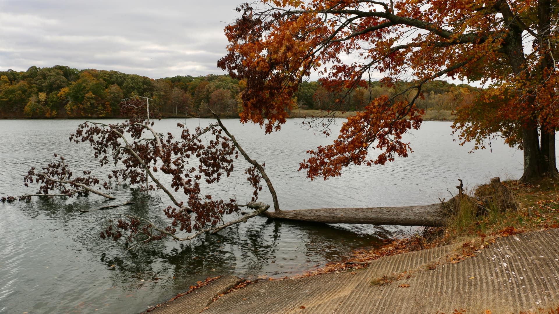
This image shows a peaceful lake surrounded by trees with beautiful fall colors—orange, red, and brown leaves. Along the sandy shore, a fallen tree trunk extends into the water, and the forest edges meet the water's surface. The photo captures how water, land, and living things interact in nature.
🔬 Scientific Phenomena
Anchoring Phenomenon: Why does water collect in low areas on Earth, and how do landforms like lakes change over time?
This image represents the natural process of water collection and erosion at work. Lakes form in low areas of land where water naturally flows and gathers. The fallen tree you see illustrates weathering and erosion—processes where rocks, soil, and wood break down and change shape over time due to water, wind, and weather. Trees fall into lakes due to wind, age, or soil erosion along the banks, demonstrating how living and nonliving things constantly reshape Earth's surface.
📚 Core Science Concepts
- Landforms and Water Bodies: Lakes are landforms (natural shapes of Earth's surface) that hold freshwater and are surrounded by land. They form in areas where the land is lower than surrounding areas.
- Weathering and Erosion: Water, wind, and weather break down rocks and soil into smaller pieces and move them from one place to another. The fallen tree shows how erosion weakens banks and causes trees to fall.
- Ecosystems and Habitats: Lakes provide homes for plants, animals, and microorganisms. The trees, water, soil, and creatures all depend on each other and create a complete living system.
- Seasonal Changes: The autumn colors visible in the photo show how trees and plants change with the seasons, affecting the entire ecosystem.
Pedagogical Tip:
Rather than explaining erosion as a concept, have students observe and touch different materials (sand, clay, rocks) near a water source. Ask them to predict which materials water will move most easily. This sensory engagement helps Third Graders understand erosion as a visible, testable process they can witness themselves, not just an abstract idea.
UDL Suggestions:
Representation: Provide the image in multiple formats—printed color copy, digital version, and a simplified labeled diagram. Some students may benefit from a close-up photo of just the tree, while others need the full landscape context.
Action & Expression: Allow students to show their learning through drawing, building a model lake with sand/water, or dictating observations to a peer—not just written answers.
Engagement: Connect the image to students' own experiences: "Have you seen a lake or pond near your home? What did you notice?" Personal connections increase motivation and relevance.
🎓 NGSS Connections
Performance Expectation:
3-ESS2-1: Represent data in tables and pictographs to show that Earth's surface is made up of different landforms that can be classified by their physical attributes.
Disciplinary Core Ideas:
- Earth's materials (rocks, soil, water, air) have properties that can be observed and described
- Humans depend on Earth's resources, including water, and change the environment in ways that can be helpful or harmful
Crosscutting Concepts:
- (the lake ecosystem functions as a system)
- (erosion and weathering cause slow, observable changes to landforms)
💬 Discussion Questions
- What do you think will happen to this fallen tree over many, many years? (Bloom's: Predict | DOK: 2)
- Why do you think the water collected in this low area instead of somewhere else? (Bloom's: Analyze | DOK: 2)
- How might this lake be different in summer compared to fall, when this picture was taken? (Bloom's: Compare | DOK: 2)
- If you could visit this lake, what living and nonliving things would you expect to find there, and how do they need each other? (Bloom's: Evaluate | DOK: 3)
📖 Vocabulary
- Landform: A natural shape or feature of Earth's surface, like a mountain, hill, valley, or lake.
- Erosion: The slow process where water, wind, or ice wears away rocks and soil and moves them to a new place.
- Weathering: The breaking down of rocks and soil into smaller pieces by water, wind, ice, or sunlight.
- Ecosystem: All the living things (plants and animals) and nonliving things (water, air, soil) in an area that depend on each other.
- Habitat: The natural home or place where a plant or animal lives.
🌡️ Extension Activities
- Sand and Water Erosion Model: Provide students with a shallow pan filled with sand, small pebbles, and soil. Let them pour water slowly onto a slope and observe what happens. Ask: "Which materials moved? Which stayed? Why?" Have them draw or photograph the changes. (Supports hands-on understanding of erosion.)
- Landform Classification Walk: Take students on a nature walk around the school grounds. Have them sketch and describe different landforms they see (hills, flat areas, slopes). Discuss how water moves through or collects in these areas. Create a class chart comparing the landforms. (Builds observational skills and connects concepts to real environment.)
- Lake Food Web Diagram: Have students research or brainstorm what lives in lakes (fish, frogs, plants, insects, birds). Create a large food web poster showing how lake organisms depend on each other. Include the water, sunlight, and soil as important nonliving parts. (Integrates ecosystem concepts with visual learning.)
🔍 Zoom In / Zoom Out Concepts
Zoom In: Microscopic Decomposition
When the fallen tree sits in the water, tiny living things you cannot see with your eyes—bacteria, fungi, and microorganisms—start to break it down into smaller and smaller pieces. Over months and years, these invisible "decomposers" eat away at the wood, turning it into nutrients that mix back into the water and soil. This microscopic process is part of nature's recycling system! Students can't see it happening, but it's constantly at work, which helps explain why fallen trees eventually disappear from lakes.
Zoom Out: The Watershed System
This single lake is actually part of a much larger system called a watershed—an area of land where all water flows downhill into one main water body. The trees you see in this photo send water into the soil through their roots. Rain falls on the forest, the ground, and the lake surface. Water from higher elevations flows downhill toward this lake, bringing soil and nutrients with it. This lake might eventually flow into a river, which flows into a larger river, and eventually to an ocean. One raindrop's journey could take years as it travels through forests, lakes, and rivers across many miles!
🤔 Potential Student Misconceptions
Misconception 1: "Lakes stay the same forever."
Scientific Clarification: Lakes are always changing, even though the changes happen very slowly—sometimes over years or centuries. Water levels rise and fall with seasons and rainfall. Erosion adds sediment to the lake bottom. Plants and animals come and go. Trees fall in and decompose. The shape, depth, and contents of a lake are constantly being reshaped by water, weather, and living things.
Misconception 2: "The tree fell down because it was old and weak."
Scientific Clarification: While a tree's age matters, the main reason trees fall into lakes is usually erosion of the soil around their roots. Water from the lake and rainfall washes away the soil that holds the tree's roots in place. Wind pushes on the tree. Once the soil is eroded enough, the tree tips over into the water. It's a combination of erosion, weather, and gravity—not just the tree "wearing out."
Misconception 3: "Dead things in water just disappear."
Scientific Clarification: The fallen tree doesn't simply vanish. It breaks down slowly through decomposition (when bacteria and fungi eat it), gets broken into smaller pieces by waves and ice, and becomes part of the lake ecosystem. Some of it sinks to the bottom and becomes part of the sediment. Some becomes food for fish and aquatic insects. The tree's materials are recycled back into the environment—nothing truly disappears; it just changes form.
🔗 Cross-Curricular Ideas
Math Connection: Measuring and Graphing Water Levels
Have students collect data on the lake's water level or a school pond over several weeks (or use provided data). Create a simple line graph showing how water levels change with rainfall, temperature, or season. Discuss: "When was the water highest? When was it lowest? Why?" This connects measurement, graphing, and pattern recognition to Earth science observations.
ELA Connection: "A Tree's Journey" Narrative Writing
Ask students to write or dictate a short story from the perspective of the fallen tree: "I used to stand on the shore. Then one windy day... Now I float in the lake and..." Students can illustrate their story and share it aloud. This builds narrative skills while deepening understanding of erosion, weathering, and change over time in a creative, engaging way.
Social Studies Connection: How Humans Use Lakes
Discuss how people depend on lakes for drinking water, fishing, recreation, and transportation. Show pictures of communities built near lakes throughout history. Ask: "How is your life connected to lakes and water?" Have students create a simple map showing a lake, the surrounding community, and ways people use that water. This connects Earth science to human geography and resource dependence.
Art Connection: Observational Watercolor Painting
Provide the lake photo and have students create their own watercolor or colored-pencil painting, focusing on how colors change with the seasons (the browns and oranges of fall). Discuss how artists observe Earth's changes just like scientists do. Display paintings and compare how different students represented the same scene. This builds fine motor skills, observation skills, and appreciation for nature's beauty.
🚀 STEM Career Connection
- Hydrologist — Follows water — where it falls, where it goes underground, and where it comes out again.
- Try it: Observe how water flows down a ramp with different textures, like sand or gravel, and describe the patterns. (Practice: Observing and Describing)
- Tools: stream gauges, well probes, flow meters, rain gauges
- Where they work: rivers and reservoirs, water utilities, government surveys, universities
- Meet one: Newsha Ajami — How cities can use water more wisely, especially when there is not enough of it.
- Median pay: /year — "Hydrologists"
- Ecologist — Studies how living things depend on each other and on the place they live.
- Try it: Watch a short video of a lake ecosystem and describe the interactions between the living and nonliving parts. (Practice: Observing and Describing)
- Tools: quadrat frames, measuring tapes, GPS units, a field notebook
- Where they work: forests, grasslands, wetlands, universities
- Meet one: Sandra Díaz — What a plant's leaves, wood and shape tell you about how it lives — and how those traits add up across a whole ecosystem.
- Median pay: /year — "Environmental scientists and specialists, including health"
Wage figures are median annual wages for the U.S. occupation named after each one, from the U.S. Bureau of Labor Statistics, Occupational Employment and Wage Statistics (OEWS), national, May 2025. Several careers share one occupation, so their figures match.
---
Teacher Tip: This image works best as a launch activity rather than a summary. Display it on day one and let students' curiosity drive the unit. Revisit it throughout your lessons on landforms, water, erosion, and ecosystems—students will notice new details as their understanding grows!